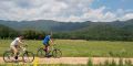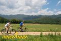

The Carrilet is for walkers and cyclists only and follows the route of the narrow gauge railway that once linked Olot and Girona.
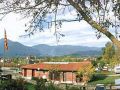
Little did the passengers on the last train to Olot suspect that decades later cyclists and walkers would be the next to follow in their tracks! If you decide to cycle or walk this route you will have the opportunity to discover some of the fascinating natural and cultural facets of this region. From Olot the route passes through a volcanic landscape and a number of charming towns, before heading more decidedly towards and eventually beyond Girona and down to the sea.
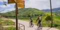
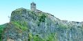
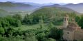
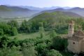
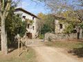
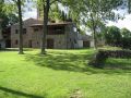
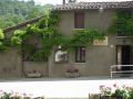
With an average gradient of 1.5%, the Carrilet cycle lane between Olot and Girona is a straightforward route and Coll de Bas, at just 620 m, is its highest point. On the way you can visit the villages and towns the route passes through: Olot, with the volcano Montsacopa in its heart and the Fonts de Sant Roc (springs) at the very start of the route; the Pedra Tosca Park and other interesting landscape features in Les Preses; the different villages of La Vall d’en Bas, home to Francesc de Verntallat, the leader of the Remences revolt in the Hostoles valley, who stormed the castle of Hostoles; Sant Feliu de Pallerols, with the river Brugent and its thick oak woods; and the Riera de Cogolls (stream and gorge) in Les Planes d’Hostoles, many places of interest in the part of the cycle lane that runs through La Garrotxa.
Other routes connect to the Carrilet and can be cycled or walked in conjunction. From Olot to Les Planes d’Hostoles, the cycle lane coincides with the Itinerànnia network of footpaths and in all the villages there are links to other paths that provide a chance to enjoy the landscapes of La Garrotxa.
The secrets of the cycle lanes
Aside from the Carrilet cycle lane itself, a number of other signposted cycle routes exist in La Garrotxa that can be used in conjunction with the Carrilet to get to know La Garrotxa that bit better: La Vall de Bianya - farmsteads and fields; Sant Feliu de Pallerols - a volcano deep in the forests; Les Preses - the home of Verntallat and the Remences peasant revolt; Olot - beechwoods and volcanoes; Olot - art and landscape; and Les Planes d’Hostoles - land, territory and the Remences peasant revolt. As well, cyclists can also tackle the Natural Park itineraries 4, 19 and 15, the last of which ends up at the Can Passavent Information Centre.
Did you know?
If you do not have a bicycle, you can hire one from one of the companies that specialise in cycle hire and transport. Bikes can be used in conjunction with public transport.
Don’t miss
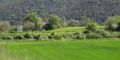
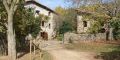
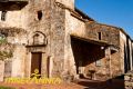
The Bosc de Tosca and, more specifically, the Pedra Tosca Park in Les Preses, is a unique rural landscape of great ecological interest. It stands on the lava flow emitted by the volcano Croscat and one of its most outstanding features are its extraordinary dry-stone walls. The dissolution of the monasteries in the nineteenth century was the signal for the beginning of a process known as artigatge, the name given to the painstaking clearing of the rocks and stones to create small patches of cultivable land, all contained within dry-stone walls. Some of these plots also contain small shelters or huts made out of volcanic stone that are a veritable joy to behold. The Les Preses Town Council and the Pedra Tosca Park organise dry-stone-wall building courses every year to ensure that this centuriesold tradition does not die out.
In the old railway station of Olot there is a charging point for electric bicycles.
Route details
·Section: Olot-Les Planes d’Hostoles
·Max. height: 602 m Min. height: 345 m
·Total climb: 162 m
·Total descent: 252 m
·Distance: 23,5 km aprox. (section between Olot and Les Planes d’Hostoles)
·How? by bike or on foot
·Signposted? Yes. Itinerànnia and Via Verda
 Accessible with help or handbike
Mileage (km)
| Girona | Bescanó | Anglès | Cellera |
Amer | Les Planes |
Sant Feliu |
Sant Esteve |
Les Preses | Olot | |
| Girona | ||||||||||
| 6,4 | Bescanó | |||||||||
| 16,7 | 10,3 | Anglès | ||||||||
| 18,2 | 11,8 | 1,5 | La Cellera |
|||||||
| 24,2 | 17,8 | 7,5 | 6,0 | Amer | ||||||
| 32,2 | 25,8 | 15,5 | 14,0 | 8,0 | Les Planes |
|||||
| 37,5 | 31,1 | 20,8 | 19,3 | 13,3 | 5,3 | St. Feliu |
||||
| 47,5 | 41,1 | 30,8 | 29,3 | 23,3 | 15,3 | 10,0 | St. Esteve |
|||
| 50,7 | 44,3 | 34,0 | 32,5 | 26,5 | 18,5 | 13,2 | 3,2 | Les Preses | ||
| 55,0 | 48,6 | 38,3 | 36,8 | 30,8 | 22,8 | 17,5 | 7,5 | 4,3 | Olot |
More information
·Itinerànnia 1:50,000 map, Editorial Alpina
·Girona Vies Verdes leaflet
·Tourist map of La Garrotxa
·Itinerary suitable for people with children
·Itinerary suitable for people with reduced mobility
* The Carrilet cycle lane is part of Pirinexus a circular route linking the north and south side of the Pyrenees route suitable for walking and cycling use.
·Do you need or prefer to be accompanied by a guide? Check the list of environmental and cultural guide companies.