


The county of La Garrotxa is in the extreme east of the Pyrenees and covers an area of 735 km2, split into 21 municipalities.
Argelaguer, Besalú, Beuda, Castellfollit de la Roca, Olot, Les Planes d'Hostoles, les Preses, Maià de Montcal, Mieres, Montagut i Oix, Riudaura, Sales de Llierca, Sant Aniol de Finestres, Sant Feliu de Pallerols, Sant Ferriol, Sant Jaume de Llierca, Sant Joan les Fonts, Santa Pau, Tortellà, la Vall de Bianya and la Vall d’en Bas are the 21 municipalities of La Garrotxa.
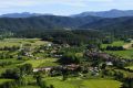
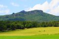
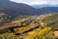
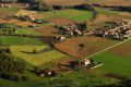
It is the most easterly mountain county and the one with the lowest average altitude: most of its surface is less than 600m above sea level and the highest parts are not above 1,600m, differentiating it from the rest of the mountain counties. The relief is characterised by its transition from the mountain to the plain and by the existence of a volcanic zone, something that makes it especially distinct.
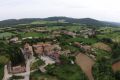
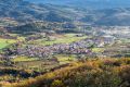
The river Fluvià divides the county into two parts: the Alta Garrotxa and the Olot plain. The former presents an abrupt relief and a landscape that has been relatively unaltered by human activity. The latter, situated to the south of the Fluvià, comprises a softer landscape, characterised by the presence of volcanoes in the La Garrotxa Volcanic Zone Natural Park and by being the most populated zone.
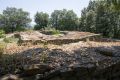
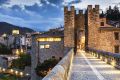
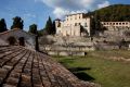
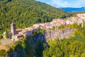
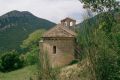
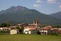
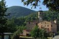
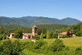
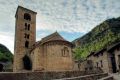
The county is formed around four large valleys: La Vall d'en Bas to the southeast, La vall d'Hostoles to the south and La Vall de Bianya to the west. In the east La Vall del Fluvià opens out towards the Empordà. Besalú, with an important medieval quarter, is found here, as is Beuda, with its important Romanesque churches.